Frame not included.
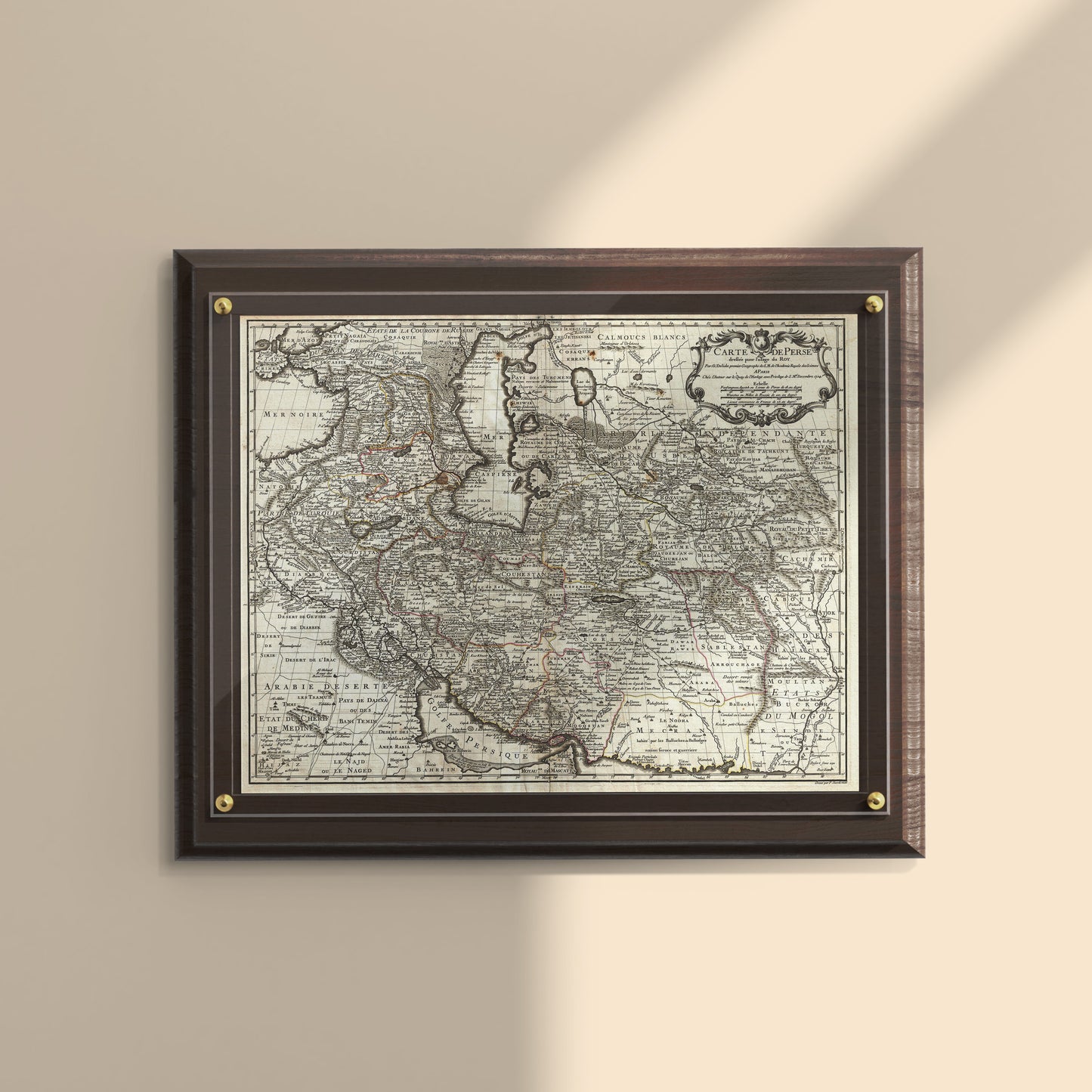
Map of Persia and the Persian Gulf, Guillaume De L'Isle, 1724, Art Print
A fine first edition of Guillaume De L'Isle's landmark 1724 map of Persia, one of the most cartographically significant European maps of the region ever produced. Stretching from the Crimea and the Sea of Azov in the north to the Persian Gulf and the Strait of Ormuz in the south, and east to Kashmir and Kabul, this map captures the full breadth of the Persian world, encompassing modern-day Iran, Iraq, Afghanistan, Azerbaijan, Armenia, Georgia, Uzbekistan, Turkmenistan, Tajikistan, Kuwait, and beyond.
De L'Isle's map was a major leap forward in Western understanding of Persia. Drawing on Russian cartographic surveys, Persian and Arabic sources, and intelligence from Georgian and Armenian traders active throughout the region, he produced a map of remarkable accuracy and depth. His rendering of the Caspian Sea is among the first in Europe to reflect Van Verden's precise 1721 survey. He also correctly identified Terheran (Tehran), the future capital of Iran, at a time when it was absent from virtually all other European maps.
The Silk Route centers of Bukhara, Samarkand, and Ferghana are carefully mapped, and the Persian Gulf is prominently charted, affirming its historic role as the heart of Persian maritime trade. Drawn by Guillaume De L'Isle and engraved by P. Starckman, this map was later included in De L'Isle's 1731 Atlas de Geographie and reissued by Buache, Covens & Mortier, and others.
Product Details
-
Size: 8 × 10 inches
-
Format: Wall Art / Desktop Art
-
Paper: Premium textured cardstock
-
Origin: Designed and crafted in Canada
Why You'll Love It
- A reproduction of one of the most important European maps of Persia, featuring the Persian Gulf in full
- Rich in historical detail, from Tehran's earliest cartographic appearance to the Silk Route and Caspian Sea
- Frame it as wall art, or prop it up as desktop art
- A meaningful gift for proud Iranians, history enthusiasts, and map collectors
Frame not included.